Cyclonic storm GAJA expected to move away from island today
November 16, 2018 09:56 am
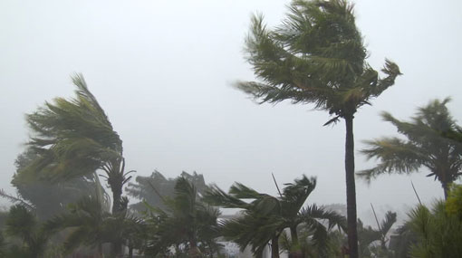
The Severe Cyclonic storm ‘GAJA’ over the Southwest Bay of Bengal is likely to move away from the country by today (16), the Department of Meteorology stated.
Hence windy and showery condition in the Northern part of the island and Northern sea area is expected to reduce gradually from this evening.
The system has further moved west-southwestwards and crossed Tamil Nadu and Puducherry coast of South India during 00.30 am and 02.30 this morning (16).
It is located near latitude-10.4N, Longitude-79.7E at 02.30a.m., approximately 75 km away from Kankesanturai to the north-northwest of Sri Lanka.
The system is very likely to move westwards and weaken gradually into a cyclonic storm during the next 6 hours.
Showers or thundershowers will occur at times over the Northern Province and in Puttalam district. Heavy falls above 100mm can be expected in the Jaffna peninsula.
Several spells of showers will occur in Anuradhapura district.
Showers may occur in the western coastal areas.
Showers or thundershowers will occur at several places in Central, Sabaragamuwa and Uva provinces after 2.00.p.m.
High winds (70-80) kmph, gusting up to 100 kmph can be expected over Northern province, particularly over the Jaffna peninsula and strong winds (50-60) kmph, gusting up to 70kmph can be expected over Puttalam and Anuradhapura districts in the morning.
Misty conditions may occur at some places in the Central, Sabaragamuwa and Western provinces during the morning.
Sea areas:
The Department of Meteorology issues an advisory for the fishermen prevent from venturing into sea areas off coast extending from Trincomalee to Puttalam via Kankesanturai and Mannar.
Showers or thundershowers will occur in the sea areas off the coast extending from Trincomalee to Puttalam via Kankesanturai. Heavy showers or thundershowers can be expected in the sea areas off the coast extending from Mullaitivu to Mannar via Kankesanturai.
Winds will be North-westerly to Westerly over the sea areas around the island and speed will be 30-40 kmph.
High winds (80 - 90) kmph, gusting up to 110kmph can be expected over the sea areas off the coast extending from Mullaitivu to Mannar via Kankesanturai will be very rough at times from today evening.
Sea areas off the coast extending from Batticaloa to Mullaitivu via Trincomalee can be rough at times as the wind speed can increase up to (60-70) kmph.
Sea areas off southern coast can be fairly rough at times as the wind speed can increase up to 50 kmph.