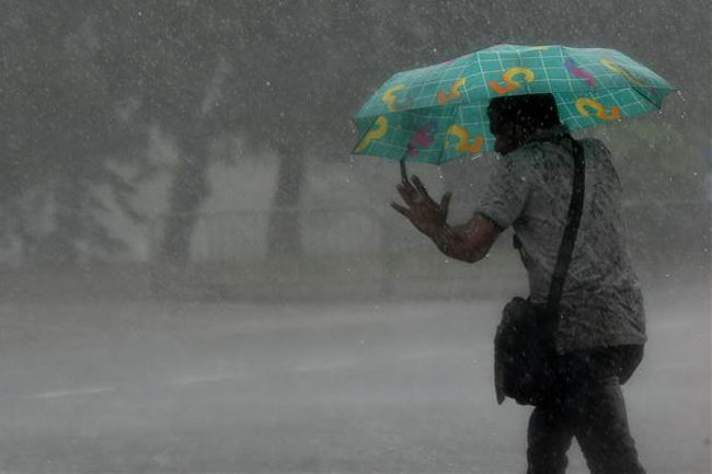
Heavy rainfall above 100mm in northern parts of the island
December 4, 2020 09:31 am
The cyclonic storm Burevi has weakened into a deep depression and located about 143 km to the west-northwest of Mannar at around 02.30 am today, says the Department of Meteorology.
It is moving further away from the country, hence the influence of this system is expected to be gradually reduced.
Showers or thundershowers will occur at times in the Northern, North-central and North-western provinces.
Heavy rainfall above 100mm can be expected at some places in Northern, and North-western provinces and in Anuradhapura district.
Several spells of showers may occur in Western, Sabaragamuwa and Central provinces and in Galle and Matara districts.
Wind speed can increase up to (40-50) kmph at times in Northern, North-Central and north-western, provinces.
Sea areas:
Showers or thundershowers will occur at times in the deep and shallow sea areas extending from Puttalam to Trincomalee via Mannar and Kankesanturai.
Very heavy showers can be expected in some places in aforementioned sea areas. Showers will occur at times elsewhere.
Winds will be westerly to south-westerly in the sea areas extending from Puttalam to Mullaitivu via Mannar and Kankesanturai.
The wind speed will be (55-65) kmph and it can increase up to 75 kmph at times over these sea areas.
Winds will be south-westerly in the sea areas extending from Galle to Hambantota via Matara. Wind speed will be (30-40) kmph and wind speed can increase up to 50 kmph at times in these sea areas.
Winds will be south-westerly or variable in the other sea areas around the island and the wind speed will be (30-40) kmph.
The deep and shallow-sea areas off the coast extending from Puttalam to Mullaitivu via Mannar and Kankesanturai can be very rough at times.
The sea areas extending from Galle to Hambantota via Matara can be rough at times.
There is a possibility that nearshore sea areas off the coast extending from Puttalam to Kankesanturai via Mannar may experience surges due to the effect of swell waves, having (0.5-1.0) m height, particularly in the morning hours.
Naval and fishing communities have been advised not to venture into the deep and shallow sea areas off the coast extending from Puttalam to Mullaitivu via Mannar and Kankesanturai until tonight.