Fairly heavy falls expected in some places
May 16, 2021 08:41 am
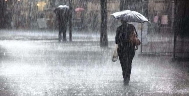
Showers or thundershowers will occur at times in Western, Sabaragamuwa, Central, and North-western provinces and in Galle and Matara districts, the Meteorology Department said.
Several spells of showers will occur in Northern and North-central provinces and showers or thundershowers will occur at a few places in Eastern and Uva provinces during the evening or night.
Fairly heavy falls of about 50 mm can be expected at some places in Sabaragamuwa province and in Kaluthara, Galle, Matara, Nuwara-Eliya, and Kandy districts.
Wind speed can increase up to 30-40 kmph at times over the island. Wind speed can gust up to 50 kmph particularly in the Western slope of the Central hills, Northern, North-central, and North-western provinces.
The general public is kindly requested to take adequate precautions to minimize damages caused by temporary localized strong winds and lightning during thundershowers
SEA AREAS
The Cyclonic Storm ‘TAUKTAE” over the southeast Arabian sea intensified into a Severe Cyclonic Storm and lay centered at 11.30 p.m. on 15th May, near latitude 14.4°N and longitude 72.7°E.
It is very likely to intensify into a Very Severe Cyclonic Storm within the next 06 hours. The system is likely to move nearly north-northwestwards and cross Gujarat coast India around the evening of 18th May.
Naval and fishing communities are advised not to venture into the abovementioned sea areas.
Showers or thundershowers will occur at times in the sea areas extending from Kankesanturai to Galle via Mannar and Colombo. Showers or thundershowers will occur at several places in the other sea areas around the island.
Winds will be westerly to south-westerly in the sea areas around the island. Wind speed will be 40-50 kmph in the sea area extending from Kankesanturai to Puttalam via Mannar. Wind speed will be 30-40 kmph in the other sea areas around the island.
Wind speed can be increased up to 60 kmph in the sea area extending from Kankesanturai to Puttalam via Mannar and wind speed can be increased up to 50 kmph in the sea in the sea area extending from Puttalam to Hambantota via Colombo and Galle.
The sea areas extending from Kankesanturai to Puttalam via Mannar will be rough to very rough. The sea area extending from Puttalam to Hambantota via Colombo and Galle can be rough at times. The other sea areas can be fairly rough.
There is a possibility that nearshore sea areas off the coast extending from Mannar to Hambantota via Galle, may experience surges due to the effect of swell waves, having 2.0-32.5 m height (This is not for the land areas).
Temporarily strong gusty winds and very rough seas can be expected during thundershowers
Naval and fishing communities are advised not to venture into the sea areas extending from Kankesanturai to Puttalam via Mannar.
The fishing and naval community are requested to be vigilant in the sea area extending from Puttalam to Hambantota via Colombo and Galle.