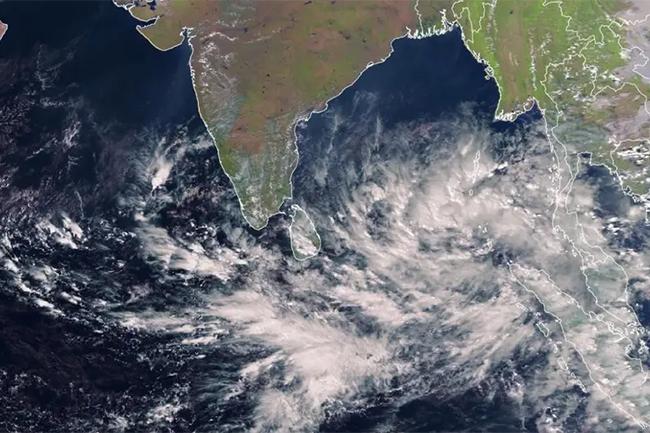


The depression located over the southeast Bay of Bengal (320km northeast of Trincomalee) is likely to move west-northwestwards, and intensify further gradually into a cyclonic storm this evening (Dec. 07), the Department of Meteorology says.
The system is likely to approach the coast of North Tamil-Nadu, Puducherry and South Andhra Pradesh over the southwest Bay of Bengal tomorrow.
Cloudy skies will prevail over most parts of the Island.
Showers will occur at times in the Northern and North-central provinces and in Trincomalee district. Fairly heavy rainfall above 75 mm can be expected at some places in Northern province and Trincomalee district.
Strong winds of about 40-50 kmph can be expected at times over the Northern, North-Central and Eastern provinces.
A few showers may occur in Western province and in Galle and Matara districts.
Sea areas:
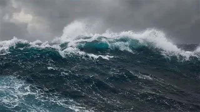
Due to the depression over Southeast Bay of Bengal, the deep and shallow sea areas of northern and eastern coast will be very rough with strong gusty winds and heavy rain during December 07, 08 and 09.
Naval and fishing communities are advised not to venture into the deep and shallow sea areas off the coast extending from Mannar to Pottuvil via Kankesanturai, Trincomalee & Batticaloa and Southwest Bay of Bengal until further notice.
The fishing and naval communities are requested to be attentive to future forecasts issued by the Department of Meteorology in this regard.
Showers or thundershowers will occur at times in the sea areas off the coast extending from Kankesanturai to Galle via Trincomalee, Batticaloa, Pottuvil and Hambantota.
Winds will be northerly to north-westerly. Wind speed will be 40-50 kmph and gusting up to 60-70 kmph at times over the sea area extending from Kankesanturai to Pottuvil via Trincomalee & Batticaloa.
The wind speed will be 20-30 kmph and gusting up to 40-50 kmph at times in the other sea areas around the island.
The sea areas off the coast extending from Kankesanturai to Pottuvil via Trincomalee & Batticaloa will be very rough. Other sea areas around the island will be moderate, fairly rough at times.