





Authorities have identified 60 locations across Colombo facing drainage blockages, prompting the launch of an institutional effort to clear obstructions and tackle recurring urban flooding.
The locations span five electoral constituencies within the Colombo Municipal Council limits —Colombo North, Colombo East, Colombo West, Borella and Colombo Central.
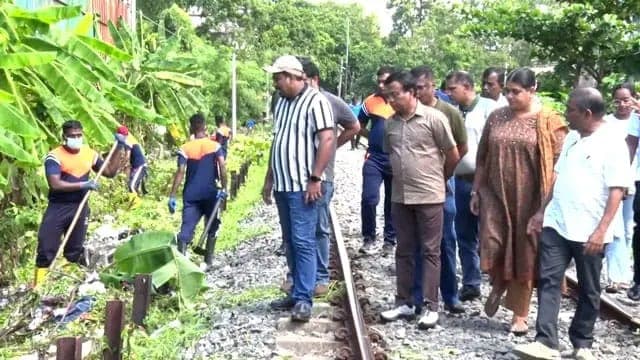
The Ministry of Transport, Highways and Urban Development said clearing operations began today (08), with immediate priority given to areas facing severe drainage obstructions and a high risk of flooding.
A special joint operation involving several government institutions was launched to address flooding and flash floods triggered by heavy rainfall in Colombo and its surrounding suburbs.
Meanwhile, field inspections and drainage-clearing work are currently underway at several identified hotspots, including Kirimandala Mawatha in Narahenpita, Haig Road in Bambalapitiya, Collingwood Place, the Cooray Urban Housing Scheme, Stafford Road and the adjoining Kirulapone Canal, New Bazaar in Central Colombo, De Mel Road and Paradise Road.
The latest initiative follows torrential rainfall on Friday evening (06), which left several parts of Colombo under water, including Pettah, Dematagoda, Orugodawatta, Colpetty, Bambalapitiya and Kompanna Veediya.
Poor maintenance of drainage systems over the years, unauthorised constructions, unplanned urban development and a lack of coordination among government institutions have been identified as key factors contributing to the recurring flooding.
Authorities said the programme is intended to go beyond clearing existing blockages, with a focus on implementing long-term and sustainable measures to reduce Colombo's vulnerability to flooding.
The Sri Lanka Army, Colombo Municipal Council, Sri Lanka Land Development Corporation, Urban Development Authority and Road Development Authority are among the agencies involved in the joint operation.